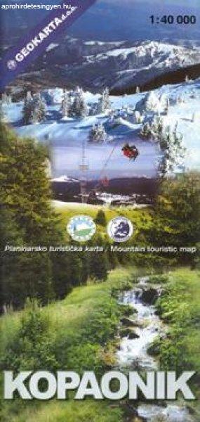
Kapaonik turistatérkép (No7) - Geokarta
Ár: 5.490 Ft
térkép 1: 40 000 76x60cm Geokarta Szállítási határidő: 2 hét A megszokottól eltérő szállítási csatornák miatt előfordulhat, hogy a készleten nem lévő termékek szállítási ideje a vártnál hosszabb lesz. Elképzelhető, hogy a beérkezett termék borítója, vagy paraméterei valamelyest eltének a webáruházban találhatótól. Kopaonik National Park on a detailed contoured map at 1:40,000, plus a plan of the resort at Suvo Rudište, a road map of the wider region surrounding the park, panorama map of ski runs, plus notes on fauna and flora, etc. The main map at 1:40,000 covers the park and the surrounding area with Serbia’s highest mountain Pancic Peak and has contours at 20m intervals, plus graphics and colouring for rocky areas, swamps, deciduous and coniferous forests, etc. Different levels of protection zones are marked and an overprint highlights waymarked hiking trails indicating difficult sections, plus cross-country ski routes. Ski and char lifts are shown, as well as mountain huts and shelters, hotels, viewpoints, etc. The map has no geographical coordinates. Map legend includes English. Also provided is a street plan of Suvo Rudište indicating hotels and other accommodation and various services, plus ski and chair lifts. A panorama drawing of the slops shows the lifts and the downhill routes, with a separate table indicating the length and the degree of difficulty. Also provided is a road map of the surrounding region and notes about its fauna and flora, etc.

Tulajdonságok
| A hirdető: | Kereskedés hirdetése |
| Értékesítés típusa: | Eladó |
| Állapota: | Új |
| Feladás dátuma: | 2025.04.10 |
| Eddig megtekintették 42 alkalommal | |
Könyvek rovaton belül a(z) "Kapaonik turistatérkép (No7) - Geokarta" című hirdetést látja. (fent)
